NOTE: The opinions expressed here are Guy Burgess's
and not necessarily those of the Boulder Area Trails Coalition.
Original Letter to the Editor Introducing this Slide ShowThe ongoing the debate over the proposed takeover of Boulder Mountain Parks by the Open Space Department seems to me to be part of a much larger debate between two very different images of environmental protection.On the one hand you have the "environment firsters" who seem to dominate Open Space. This group appears to view human society is a kind of cancer growing on the natural environment which must be fought at every possible opportunity. When they see open spaces being enjoyed by more and more people they don't see success. Instead, they see a failure to prove preserve Boulder the way of was before all the people came and ruined things. This philosophy leads them to respond to increased recreational demands with measures designed to limit access. A superior alternative is offered the "social ecologists" who manage Mountain Parks. They view the human and natural environments is a single interdependent ecosystem in which humans have rightful place in the environment. They believe that it is good for more and more people to be enjoying the city's open spaces, though they also believe that visitors should follow an ethic of low impact use. Social ecologists also believe that land managers have a responsibility to provide quality recreational experiences while also working to limit adverse environmental impacts. Their philosophy is one which increases support for environmental by giving more and more people a personal stake in its protection. For an online slide show illustrating how these two philosophies are reflected in the management policies of the two organizations see my essay on the BATCO Web Site (http://bcn.boulder.co.us/batco). I am not against increasing efficiency and consolidating duplicative programs. I am against the takeover of well run department by one that does not protect the public's interests. Guy Burgess
|
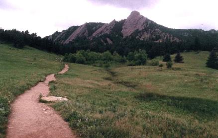
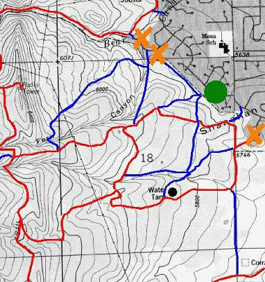
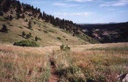
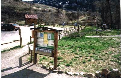
Mountain Parks Lands
The area north of Bear Creek is managed
by Mountain Parks. This includes the Chautauqua Meadow / Flatirons area
pictured here.
Open Space Lands
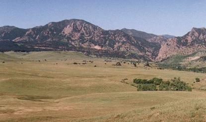
Bear Peak Area
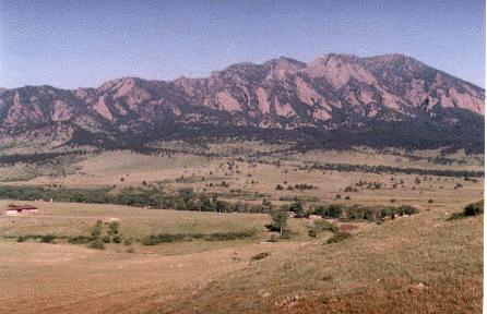
Eldorado Mountain Area
The much larger area south of Bear Creek (and
shown in the above two pictures) is controlled by the Open Space Department.
(This is true even though the Mountain Parks Department is responsible
for the management of the cliffs in the Bear Peak area. The mesa tops,
grasslands, trailheads, and almost all of the trails are controlled
the Open Space Department.)
NOTE: The other slideshow contains more detailed and up to date information on this next section. This skip this section click here. To go to the other slideshow click here.
Access to Open Space land is much more difficult
with a variety of problems leading to the exclusion of large number of
hikers. For example, 7,000 acres of supposedly open Open Space land is
completely fenced with locked gates. (This is an area roughly the size
of the Boulder Mountain Parks.) Other problems are illustrated by the following
pictures.
Fern Canyon Trailhead Closure
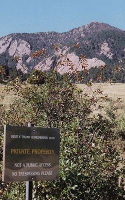
South Boulder has a spectacular meadow very similar
to Mountain Parks' beloved Chautauqua Meadow. Here the Open Space
Department maintains a wonderful trail along the old Fern Canyon road.
Hikers seeking to take this trail will, however, find their access blocked
by this sign announcing access to this trail is for Devils Thumb Homeowners
Association members and guests ONLY.
Shanahan Ridge Parking Restriction
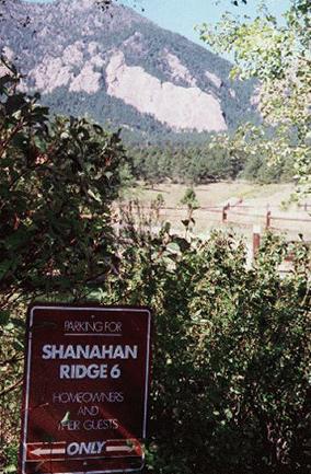
The official Open Space map shows that the only
trailhead for the Open Space Department's Shanahan Ridge area trails is
located at the end of Hardscrabble Drive. Here, however, hikers are
greeted by another sign indicating that parking here is ONLY
for homeowners association members and guests.
Unmapped, Unmarked, and (Not Surprisingly) Little Used Trailhead at Cragmoor Drive
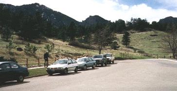
While there is a publicly accessible trailhead
for the area located at the end of Cragmoor Drive, it is not marked on
park maps and there are no signs indicating how hikers can find the many
trails in the area. It is used almost exclusively by neighbors who know
the area. Here you see only a few cars in spite of the fact that this is
a weekend and all other trailheads are jammed.
Unmapped and Unmarked BUT Maintained or Constructed Trails
Ticketed Cars and the New "Get Tough" Parking Policy Has Dramatically Restricted Access to the South Mesa Trail and Dowdy Draw areas.
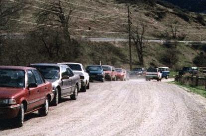
Further south, at the Mesa Trail and Dowdy Draw
trailheads, the Open Space Department maintains its only major parking
lots in the area. Here, while the number of hikers has increased Open Space
has been dramatically reducing parking capacity. It has outlawed
roadside parking and, in effect, has instituted an access rationing system
in which large numbers of the potential open space users are turned away
and many more receive tickets for perfectly safe roadside parking (see
picture).
Original Mesa Trail to Eldorado Springs
The original Mesa trail connection to Eldorado Springs is still widely used by neighbors even though access for the general public is blocked by no trespassing signs and has been dropped from official trail maps.
The Bottom Line
While open space neighbors bear some responsibility for these access problems, the bottom line is that the Open Space Department does not view maintaining public access as a significant priority. In fact, reducing visitation is an often stated goal of the Department.
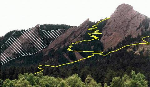
Yellow = New Trail; Crosshatch = Seasonal Wildlife Closure
Especially impressive is the Mountain Parks' new First Flatiron trail which ascends the tree filled gully between the First and the Second Flatirons. With a series of spectacular switchbacks, this trail gives everyday hikers the thrill of climbing the Flatirons with incomparable views (and, even, the opportunity to fall hundreds of feet). This trail has also eliminated a severe erosion problem caused by rock climbers scrambling all over the steep hillside.
More First Flatiron Trail Views
A trail overlook on the actual face of the Second Flatiron.
Third Flatiron from behind the Second Flatiron
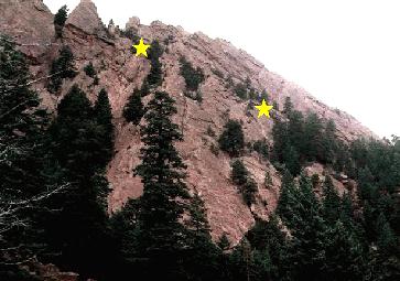
Yellow Stars = Viewpoints on the First Flatiron Trail
This is really one of the most beautiful trails to be found anywhere and it is only one of the many exciting recreational experiences that the Mountain Parks has created recently.
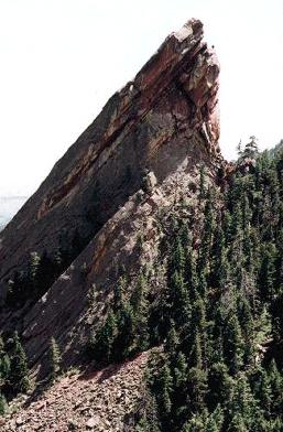
Seasonal Closures
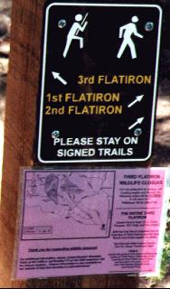
Mountain Parks is also acting to protect the environment
with numerous measures including seasonal closures on their most popular
and famous climbing rock, the Third Flatiron, rerouting of trails to avoid
sensitive environmental areas, and proactive maintenance to prevent erosion
problems.
Roadside "Cattle Chute" Trail
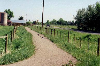
I have been told that Open Space policy is to
minimize the number of the new trails and locate any trails that are constructed
on the periphery of Open Space land wherever possible. This means that
new trails are often located on the fence lines or even in the road right-of-way.
This roadside, double fenced, "cattle chute" trail illustrates the kind
of new trail the Open Space often favors.
Closed Trailside and Creekside Rest Area
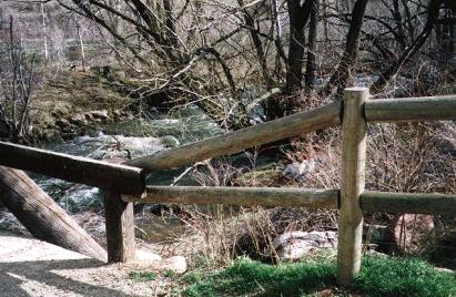
Also illustrative of Open Space priorities is this fence which prevents hikers from stepping off trail to enjoy a few moments sitting alongside South Boulder Creek.
South Mesa Trail Parking Lot Converted to Picnic Area
This picnic area was created in the old South Mesa Trail parking area. Not only did it create a poor user experience, it significantly reduced available parking.
For more information click here to go to the other slide show on the two-tier access problem