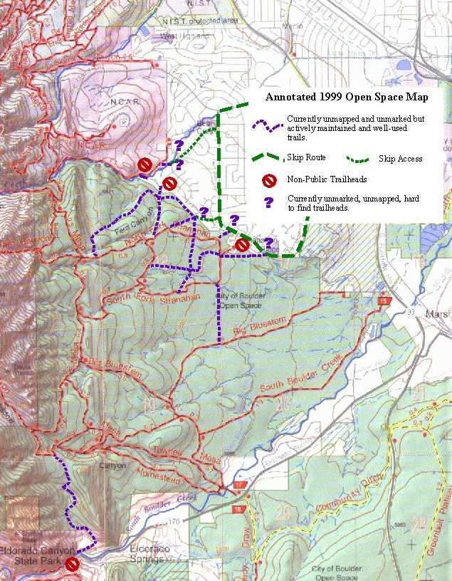
For Open Space neighbors and others "in the know," there are many more opportunities to enjoy the area. The Open Space Department (and, occasionally, neighbors) actively maintain an extensive series of unmarked and unmapped, but well-used trails and trailheads in the area. On this map these trails are marked as dashed purple lines with publicly accessible but hard to find trailheads marked with purple question marks. Red closed symbols mark trailheads which are reserved for neighbors only.
These are all major trails with minimal adverse environmental impacts. They are trails which should be open and part of the system. There are lots of other, inappropriate social trails in the area which have not been included on this map. There are also likely to be ways in which modest trail redesign and realignment efforts can further limit adverse environmental impacts associated with these trails.
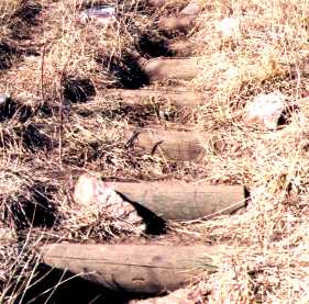
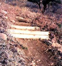
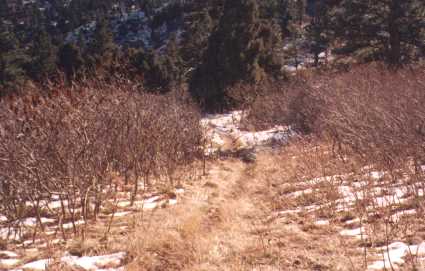
As far as I have been able to determine no significant efforts have been made to close these trails. On the contrary major effort has been devoted to maintaining and in some cases reconstructing these trails. Examples of this work include the following. (All pictures have been taken on the area's extensive network of unmarked and unmapped trails.)
I realize that some readers may find this surprising and hard to believe. I would be happy to take you for a tour or draw you a self-guided map if you want more details than those provided here.
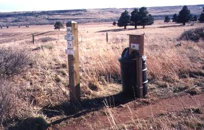
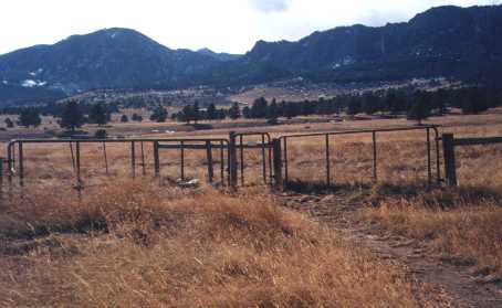
This gate is on an area social trail which was omitted from the map. A similar gate is a key element of the Shanahan / Big Bluestem Trail.
While the Open Space Department can argue that these areas are technically open to the general public, they are certainly being managed in ways which limit access to neighbors and the relatively few environmentally incorrect citizens who actively explore unmarked social trails. The assumption seems to be that use of these trails by neighbors is acceptable but that making the larger community aware of their existence is inappropriate.
Next group of slides examines the Fern Meadow trail in light of the DTHA agreement.