
City of Boulder/USGS Water Quality Monitoring
Boulder Creek Watershed
Snowtel Snow Pack Monitoring

The following map provides access to the automated USDA SNOTEL stations within Boulder and Saint Vrain watersheds. If javascript is enabled in your browser the name of the station will be displayed in the text box below. Select on the site marker to access an interactive graphing tool for that site.

Additional Snow Pack links are listed below . During the pack accumulation season BASIN also posts snowpack reports from CU's INSTARR Mountain Research Station.
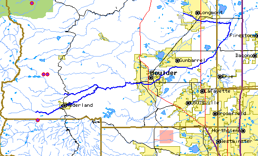
Indicated monitoring site:

Other information and data on snowpack measurements

Return to the BASIN environmental data catalog


Thank You! BASIN was a community project which benefitted from over 1000 hours of public volunteer time. BASIN was highlighted by the US EPA in a national case study in its 2001 handbook Delivering Timely Environmental Information to Your Community. Thank you to all volunteers, and especially to the late Jim Waterman, BASIN Project Coordinator!

BASIN was funded through the US EPA EMPACT Program

Home | Site Map | Glossary | Bibliography | Contributors
About BASIN | Attribution | Feedback | Search
Last Page Update - Tuesday December 27, 2005