Watershed Address:
Bear Canyon Creek, Boulder
Creek, St. Vrain, South Platte, Platte, Missouri, Mississippi,
Gulf of Mexico
Approximate length: Nine Miles
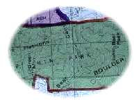
Description: Draining
the the north face of Bear Mountain and the southern flank of Green
Mountain, Bear Canyon Creek emerges from its canyon and flows through
what are now Table Mesa and Martin Acres neighborhoods, joining
its major tributary Skunk Creek near Aurora 7 Elementary school.
The confluence of Bear Canyon Creek with main Boulder Creek is south
of Arapahoe Avenue in the Univesity of Colorado Research Park.
As with many of the mountain streams in the area,
when it floods, Bear Creek carries a heavy load of sediment and
debris, filling the channel of the stream with sand and gravel and
then spilling from its banks. In early May of 1969 Table Mesa Drive
near Broadway was a muddy mess due to flooding. The FEMA Flood Insurance
Report notes:
On May 8, 1969, the Boulder Daily Camera reported
that "motorists were still being routed around the intersection
of Talbe Mesa Drive and Broadway, where Bear Creek rages out of
its banks, flooding the entire area Wednesday."
Also see
1969 Flood in BASIN History.
Click
here for a video clip of Bear Canyon Creek flooding in 1969.
Nearby Neighborhoods (upstream
to downstream)
- Table Mesa
- Martin Park
- Williams Village
Schools
- Mesa Elementary
- Bear Creek Elementary
- New Vista High School
- Martin Park Elementary
- Aurora 7
Flash Flood Data
Source: FEMA (Federal Emergency Management Association)
June 2, 1995 Flood Insurance Study
|
Flooding Source & Location
|
Drainage Area (Square
Miles)
|
Peak
|
Discharge
|
(CubicFt.
|
per Sec.)
|
|
10-year
|
50-year
|
100-year
|
500-year
|
|
Confluence w/ Boulder Creek
|
8.24
|
2,050
|
3,762
|
4,880
|
7,500
|
|
Confluence w/ Skunk Creek
|
5.35
|
1,170
|
2,360
|
3,070
|
5,100
|
|
Baseline Rd.
|
4.96
|
1,110
|
2,352
|
2,930
|
5,000
|
| U.S. Hwy. 36 |
4.34
|
820
|
1,780
|
2,210
|
3,850
|
| Broadway |
4.08
|
680
|
1,512
|
1,930
|
3,400
|
|
Upstream Limit of Study
|
3.71
|
480
|
1,190
|
1,600
|
3,000
|
BEYOND BASIN:
It is our intent to build a comprehensive information resource
based on the local watershed theme. One way you can help us develop
this area of the BASIN WWW site is to take
this quick survey. Your input is greatly appreciated.
Do you have a comment or question about this area ? Select
here for a more general BASIN feedback form.
Return to top
|
|
