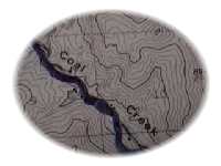
BASIN Home
BASIN Text Image
Current Theme: Wastershed Address
Coal Creek Information

Coal Creek 
Stats 
Description
Neighborhoods
Schools
Flood Data
Feedback Form

Watershed Address: 
Coal Creek, Boulder Creek, St. Vrain, South Platte, Platte, Missouri, Mississippi, Gulf of Mexico 

Approximate Length: 29 miles

Description: Originating on the eastern flank of Thorodin Mountain near the town of Wondervu, Coal Creek carves a canyon that empties onto the plains west of Rocky Flats, then swings east and north through the Town of Superior, Louisville, Lafayette and Erie before joining Boulder Creek. Coal Creek drains about 14% of the Boulder Creek Watershed.

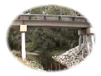
According to the FEMA Flood Insurance Study:
"Historical documentation of flood damange is meager in the area of the City of Lafayette and the Town of Superior.... 
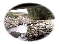
Major flood damanges in the watershed are to roads, bridges, irrigation structures, and agricultural land. Duration of flooding is brief, due to steep slopes and small drainage area. In general, peak flows last from 1 to 4 hours during a flooding period of 6 to 24 hours.

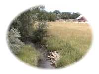
In recent years there has been concentrated urban development along Coal Creek and its tributary Rock Creek.

Also see 1896 Coal Creek and 1921 for more on flash floods along Coal Creek in BASIN History.

Nearby Neighborhoods (upstream to downstream) 

  • Wonderview
  • Superior
  • Louisville
  • Lafayette
  • Erie

Schools 

  • Centaurus
  • Louisville Elementary
  • Louisville Middle
  • Pioneer Elementary
  • Ryan Elementary
  • Angevine Middle
  • Coal Creek Elementary
  • Fireside Elementary
  • Lafayette Elementary

Flash Flood Data  
Source: FEMA (Federal Emergency Management Association) June 2, 1995 Flood Insurance Study

Flooding Source & Location
Drainage Area (Square Miles)
Peak
Discharge
(Cubic Ft.
per Second)
10-yr.
50-yr.
100-yr.
500-yr.
Confluence w/ Rock Creek 
59.3
5,120
8,740
10,640
15,920
Burlington Northern Railroad  
36.3
2,330
3,490
4,120
6,170
 U.S. Hwy. 287
35.6
2,370
3,480
4,110
6,160
U.S. Hwy. 36 
27.9
1,740
3,070
3,820
6,030
McCaslin Blvd.
26.7
1,400
2,980
3,770
5,990

BEYOND BASIN

It is our intent to build a comprehensive information resource based on the local watershed theme. One way you can help us develop this area of the BASIN WWW site is to take this quick survey. Your input is greatly appreciated.

Do you have a comment or question about this area ? Select here for a more general BASIN feedback form.

Return to top  


INVITATION BASIN is a community project actively seeking public participation. We appreciate all feedback and welcome comments, suggestions and contributions. To find out more about how you can be involved, click here. Help BASIN serve your needs, take our "10 questions in 10 seconds" survey.

BASIN is supported by the US EPA, the City of Boulder, the Keep it Clean Partnership, BCWI and BCN

Home | Site Map | Glossary | Bibliography | Contributors
About BASIN | Attribution | Feedback | Search
Last Page Update - Tuesday December 27, 2005