Watershed Address:
Fourmile Canyon Creek, Boulder
Creek, St. Vrain, South Platte, Platte, Missouri, Mississippi,
Gulf of Mexico
Approximate length: 19 Miles
Description:
The northern-most tributary of the Boulder Creek Watershed,
Fourmile Canyon Creek is easily confused with Fourmile Creek in
Four Mile Canyon (which joins Boulder Creek about a mile up Boulder
Canyon.)
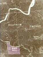
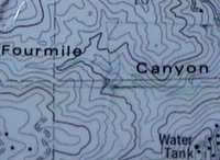
Fourmile Canyon Creek begins around the old mining
town of Sunshine, descends through the foothills and enters the
plains near what is now Lee Hill Road, then proceeding eastward
to join Boulder Creek near 63rd Street.
While there is some water in the creek as it flows
through the mountains most of the year, the creek bed may be dry
east of the mountains much of the year. Nevertheless, Fourmile Canyon
Creek poses a significant flash flood risk for residents of North
Boulder, with an anticipated 100 year flood flow of 3,520 cubic
feet per second at Broadway. (See Flood Data below)
Also see 1916, 1950,
1951 and 1955
of History of Flash Floods in BASIN History.
Nearby Neighborhoods (upstream
to downstream)
- Dakota
- Crestview West
- North 26th
- Centennial
- Palo Park
Schools
- Shining Mountain Waldorf School
- Crestview Elementary
- Centennial Middle School
Flash Flood Data
Source: FEMA (Federal Emergency Management Association)
June 2, 1995 Flood Insurance Study
|
Flooding Source & Location
(downstream to upstream)
|
Drainage Area
(Square Miles)
|
Peak
|
Discharge
|
(CubicFt.
|
per Sec.)
|
|
10-yr
|
50-yr
|
100-yr
|
500-yr
|
|
Confluence w/ Boulder Creek
|
10.03
|
920
|
2,890
|
3,960
|
8,900
|
|
Longmont Diagonal
|
9.09
|
1,050
|
2,805
|
3,930
|
7,600
|
|
28th Street
|
8.60
|
1,000
|
2,850
|
3,920
|
8,200
|
|
Broadway
|
7.92
|
830
|
2,530
|
3,520
|
7,6000
|
|
Upstream Limit of Study
|
3.93
|
350
|
1,170
|
1,750
|
4,000
|
Note: The city of Boulder
has conducted a new flood mapping study of Fourmile Canyon Creek's
floodplain after discovering that the official FEMA floodmaps were
off by four feet on a section west of Broadway near the mouth of
the Canyon. The result has been that the size of the floodplain
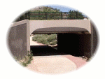
was underestimated by about half. The bridge at Broadway is built
to handle about half of the flow of a 100 year flood event.
BEYOND BASIN
It is our intent to build a comprehensive information resource
based on the local watershed theme. One way you can help us develop
this area of the BASIN WWW site is to take
this quick survey. Your input is greatly appreciated.
Do you have a comment or question about this area ? Select
here for a more general BASIN feedback form.
Return to top
|

|

