
|
|
|
The Boulder Water System didn't stay simple for long. We've gone from "shovel diplomacy" (if you didn't like what someone was doing with the upstream water you went after them with a shovel!) into an extraordinarily complex system of water law involving the federal, state, and local governments, ditch companies, agriculture, industry, and private individuals.
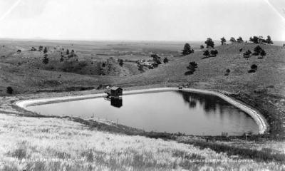
By 1862, 24 ditch companies had acquired rights to Boulder Creek Water. The first ditches were dug in 1859, just one year after Thomas Aiken and his group of goldseekers arrived in our area!
Colorado water policy began when George Coffin's corn on the St. Vrain Creek died because the Left Hand Ditch Co. (with prior rights) diverted the upstream water into Left Hand Creek. Coffin took the ditch company to court. In 1892 the Colorado Supreme Court ruled in favor of the Left Hand Ditch Company, saying that the company's right to divert water was superior to George Coffin's claim. Most importantly the Court upheld the ditch company's right to divert water into a different drainage system. This case set a precedent in water law, and became known as the "first in time, first in right" or "prior appropriation" water doctrine.
It is this policy that allows Boulder to utilize Western Slope water from the Big Thompson/Windy Gap Project. Water is taken from the headwaters of the Colorado River and then stored at Grand Lake, Shadow Mountain Lake and Lake Granby. (The later two are reservoirs, and Grand Lake is the largest natural lake in the state of Colorado.) The water is piped by tunnel through the Continental Divide to Mary's Lake, Estes Lake, Carter Lake, and Horsetooth Reservoir. The water from Carter Lake moves through the St. Vrain Supply Canal, flows underground at Rabbit Mountain, moves through the Boulder Feeder Canal into Boulder Reservoir or the Treatment Plant on 63rd Street, and finally, after an incredibly long journey, it flows into homes in East Boulder.
Other communities in the Boulder Area, including Louisville, Erie, Lafayette, Superior and Broomfield, also receive western slope water from the Big Thompson/Windy Gap project, although many of these communities must also augment this water with additional sources, including South Boulder and Boulder Creek.
All in all, Boulder receives some 40% of its water supply from Arapaho Glacier (now considered a snowfield rather than glacier) and the Silver Lake Watershed, 40% from water stored in Barker Reservoir on Middle Boulder Creek, and 20% from the Boulder Feeder Canal or the Boulder Reservoir.
Of course, "first in time, first in right" allows others access to the Boulder creek watershed. Gross Reservoir behind Flagstaff and Green Mountains is owned by the City of Denver Water District. Water from the western slope is piped through the Continental Divide at the Moffat Tunnel and, along with natural drainage from the South Boulder Creek watershed, is stored in Gross Reservoir and captured and diverted from South Boulder Creek to Denver in order to supply water to Denver homes and business. Sources
From The Many Voices of the Boulder Creek Watershed, copyright 1996 by
The Naropa Institute. Used by permission.
Beyond BASIN