Streamflow Reconstructions from Tree Rings: an Example from Middle Boulder Creek


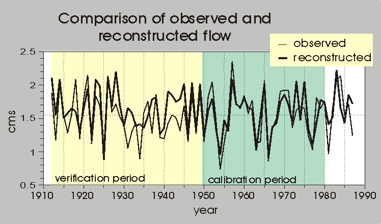
Figure 2. Comparison between observed (thin line) and reconstructed (thick line) Middle Boulder Ck. mean annual streamflow. The regression model was calibrated on the years 1950-1980 and the tested in the independent verification years, 1912-1949.

Use your back key to return to article.

Return to Drought, Fire & Flood Homepage

Drought - Fire - Flood - It's All Connected


Thank You! BASIN was a community project which benefitted from over 1000 hours of public volunteer time. BASIN was highlighted by the US EPA in a national case study in its 2001 handbook Delivering Timely Environmental Information to Your Community. Thank you to all volunteers, and especially to the late Jim Waterman, BASIN Project Coordinator!

BASIN was supported by the US EPA, the City of Boulder, WASH, BCWI and BCN
Home | Site Map | Glossary | Bibliography | Contributors
About BASIN | Attribution | Feedback | Search