|
|
|
Average Annual Water Quality Index |
|
|
|
Average Annual Water Quality Index |
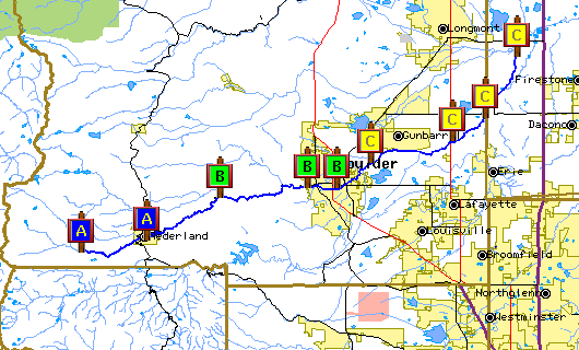
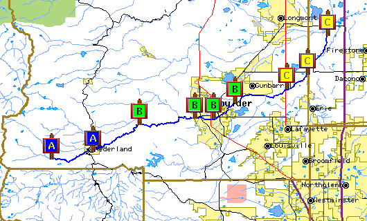
BASIN has researched several types of water quality indices and has selected an index developed by the National Sanitiation Foundation (NSF) used by many communities for characterizing overall water quality. The following maps present this index as calculated for both high flow and low flow conditions at nine sites on Boulder Creek. If your browser is javascript enabled the site description will appear in the box below when you mouse over the site grade signpost. Select on the site grade signpost to view the specific WQI computation for at that site. Select here for more information on the NSF water quality index. BASIN acknowledges that the concept of a single water quality grade is controversial. BASIN also provides a more detailed anlysis of specific Boulder Creek water quality data as well as a general discussion of the specific factors that affect Boulder Creek water quality. | |
| |
Water Quality Index for Low Flow Conditions - October 2000 | |
 |  |
Water Quality Index for High Flow Conditions - June 2000 | |
|
|
|
Additional information about the water quality of the Boulder Creek Watershed available through BASIN is available below. | |