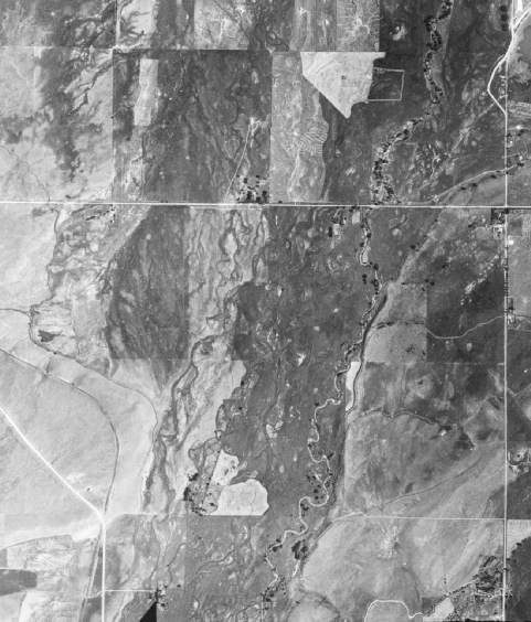
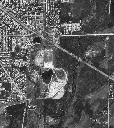
Fifty
Years Along South Boulder Creek These two images demonstrate the dramatic changes that have occurred during
a fifty year period along the floodplain of South Boulder Creek. The first, taken
by in July of 1937 by US Forest Service aerial survey crews, shows South Boulder
Road cutting across the upper third of the photograph and Cherryvale Road on the
right edge of the image. Some agriculture is evident in the broad floodplain,
but little housing. The image on the right was taken by a Soviet spy satelite
in July of 1987 from an altitude of over 200 km., shows U.S. 36 running diagonally
through the image.
July 1937
Select on image for large (600K) version
July, 1987 Select on image for large (600K) version
INVITATION
BASIN is a community project actively seeking public participation. We
appreciate all feedback and welcome comments, suggestions and contributions.
To find out more about how you can be involved, click here.
 Fifty
Years Along South Boulder Creek
Fifty
Years Along South Boulder Creek