|
Watershed Address:
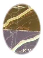
Rock Creek, Coal Creek,
Boulder Creek, St. Vrain, South Platte,
Platte, Missouri, Mississippi, Gulf of Mexico
Approximate length: Eight miles
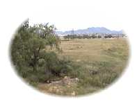
Description: Originating in springs on the
northern edge of the Rocky Flats mesa, Rock Creek runs through the
heart of the largest growing area in the state of Colorado. The
Town of Superior, which a decade ago was a sleepy community on Coal
Creek, has annexed the land along Rock Creek to the south and east.
Population growth for the Town of Superior has boomed 2234%
between 1990 and 1998.
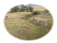
The urban growth has made an impact on the local
riparian system; with the towns of Superior, Lafayette, Louisville
and Erie discharging their treated waste water into Rock or Coal
Creeks, often the majority of the flow in the creeks downstream
from development is treated waste water.
Neighborhoods
- Rock Creek (Town of Superior)
- Interlocken (City of Broomfield)
- Lafayette
Schools
Flash Flood Data
Source: FEMA (Federal Emergency Management Association)
June 2, 1995 Flood Insurance Study
|
Flooding Source & Location
|
Drainage Area (Square
Miles)
|
Peak
|
Discharge
|
(Cubic Ft.
|
per Second)
|
|
10-yr.
|
50-yr.
|
100-yr.
|
500-yr.
|
|
Confluence w/ Coal Creek
|
21.6
|
2,870
|
5,350
|
6,690
|
10,240
|
|
Downstream Coporate Limits*
|
21.5
|
2,900
|
5,400
|
6,710
|
10,270
|
|
South 190th Street
|
21.3
|
2,910
|
5,410
|
6,740
|
10,310
|
|
Upstream Corporate Limits*
|
18.7
|
2,900
|
5,360
|
6,640
|
10,050
|
*Corporate limits refer to the City of Lafayette. Flood
data not currently available for Rock Creek development, Town of Superior.
BEYOND BASIN
Historic Flow Data from USGS:
Rock
Creek at Highway 128 at Rocky Flats Plant
It is our intent to build a comprehensive information resource based on
the local watershed theme. One way you can help us develop this area of
the BASIN WWW site is to take this quick
survey. Your input is greatly appreciated.
Do you have a comment or question about this area ?
Select here for a more general BASIN
feedback form.
Return to top
|

|
