| WATERSHED WATER
QUALITY Indicator Description |
 Stream
segments in the St. Vrain watershed whose water quality is impaired according
to state standards. Boulder County lies in the St. Vrain River watershed,
which is part of the larger South Platte River basin.
Stream
segments in the St. Vrain watershed whose water quality is impaired according
to state standards. Boulder County lies in the St. Vrain River watershed,
which is part of the larger South Platte River basin.
The data come from Colorado's 1998 303 (d) List, which is mandated by the Clean Water Act. Colorado's 303 (d) List, compiled by the Water Quality Control Division (WQCD) of the Colorado Department of Health and Environment, identifies water quality impairments to stream segments for every river basin in the state.
Why We are Measuring This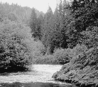 |
Water is one of the fundamental elements of life, especially in a semi-arid region such as ours. The health and sustainability of Boulder County is inextricably linked to the quality of its watershed. |
A watershed is the land area, determined by topography and hydrology, that drains water from high to low elevations. Our watershed includes lakes, rivers, estuaries, wetlands, streams, and surrounding landscapes. As water drains to the lowest point in a watershed, along the way it picks up all sorts of pollutants, such as soil particles, oil, pesticides and animal manure.
We chose the watershed approach to examining our water quality because it highlights the connection between the land, water and people. Water quality is impacted by population growth, urbanization and development and agricultural production.
There are big differences in water quality depending on whether you are downstream or upstream. For example, the water quality in the Indian Peaks high country (upstream) is nearly pristine while waters flowing below water treatment plants (downstream) tend to be more impaired with pollutants. Since population density is greatest at lower elevations, or downstream, water quality worsens as altitude lessens. High country water pollution in this region is primarily the result of historic mining activity.
There are four stream segments within our watershed that are considered impaired according to the WQCD:
- Boulder Creek, from South Boulder Creek to Coal Creek
- Boulder Creek, from Coal Creek to St. Vrain Creek
- St. Vrain Creek, from Hygiene Road to South Platte
River
Primary problem: ammonia from municipal wastewater treatment plant, which has affected populations of native fish species and other aquatic organisms. - Little James and Left Hand Creeks
Primary Problem: acute impairment due to acidic pH and high concentrations of cadmium, iron, manganese and zinc resulting from old mining operations. These creek waters are under EPA assessment, and have been assigned a high priority by WQCD
Overall, the Environmental Protection Agency rate the St. Vrain watershed "Betty Quality-Low Vulnerability." This is the best rating on their scale of watershed indicators.
Linkages: Land Annexation , Agricultural Land
Table
of Contents/ Overview/Boulder
County at a Glance/A Vision for the Environment
/
Air Quality/Extirpated and Declining Species/Water
Imports from the Western Slope/
Land Annexation/Agricultural Land/Vehicle
Miles Traveled/Recycling/Sources
of Data
Return to Close
to Home