Watershed Address:
Goose Creek, Boulder Creek,
St. Vrain, South Platte, Platte, Missouri, Mississippi, Gulf of Mexico
Approximate length: Four Miles
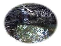
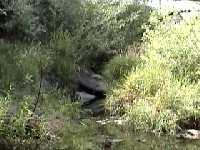
Description: Virtually
invisible due to being hidden inside culverts or running through
backyards, Goose Creek begins in near North Boulder Park, running
beneath Boulder Community Hospital and the Ideal Market and then
flowing eastward to the south of Edgewater Street. Near Folsom and
Valmont it is joined by Two Mile Creek and then Elmer's Two Mile
Creek. Its confluence with Boulder Creek is off of East Pearl Street
near the Eco Cycle drop off center.
Goose Creek is considered a major threat for flash
flooding. Bearly a trickle most of the year, it is estimated that
a 100 year (or 1%) storm event will carry over 6,000 cubic feet
per second into Boulder Creek.
The FEMA Flood Insurance Study notes:
"Significant flooding along Goose Creek occurred in August
1951 and July 1954. The 1954 event damaged an addition to the Community
Hospital, which was udner construction." (p. 14).
Nearby Neighborhoods (upstream to
downstream)
- Newlands
- Edgewood/Balsam
- Valmont & Folsom
Schools
- Columbine Elementary
- Quest Academy
Flash Flood Data
Source: FEMA (Federal Emergency Management Association)
June 2, 1995 Flood Insurance Study
|
Flooding Source & Location
|
Drainage Area (Square
Miles)
|
Peak
|
Discharge
|
(CubicFt.
|
per Sec.)
|
|
10-yr
|
50-yr
|
100-yr
|
500-yr
|
|
Confluence w/ Boulder Creek
|
5.46
|
2,865
|
5,065
|
6,315
|
9,325
|
| Confluence w/ Elmer's
Twomile Creek |
3.63
|
1,050
|
2,100
|
2,680
|
|
|
Confluence w/ Twomile
Canyon Creek
|
1.32
|
670
|
1,270
|
1,590
|
2,400
|
|
19th Street
|
1.28
|
700
|
1,320
|
1,600
|
2,450
|
|
Upstream Limit of
Study
|
.48
|
260
|
520
|
620
|
1,000
|
BEYOND BASIN
Historic Data from USGS Gauge Station:
Goose
Creek at Boulder CO
It is our intent to build a comprehensive information resource based on
the local watershed theme. One way you can help us develop this area of
the BASIN WWW site is to take this quick
survey. Your input is greatly appreciated.
Do you have a comment or question about this area ?
Select here for a more general BASIN
feedback form.
Return to top
|
|
