
![]()
BASIN is a local community service network offering public access to environmental information. BASIN's initial focus is on water in Boulder County, CO: where it comes from, goes to and how we use it. Select here for more about BASIN or see our site map. HELP US BETTER SERVE YOUR NEEDS, TAKE OUR "10 QUESTIONS IN 10 SECONDS" SURVEY
|
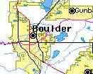
Location
|
Current values |
Historic values |
||
Stream Flow |
Date & Time |
Mean Flow |
Record length |
|
|
Boulder Creek at Broadway
(Central Boulder) |
0 cfs 0.00 cms |
25 cfs | 20 years | |
|
Boulder Creek at 75th Street
(E. of Boulder) |
cfs 0.00 cms |
cfs | years | |
|
Saint Vrain Creek
(E. of Longmont) |
cfs 0.00 cms |
cfs | years | |
|
Current Metro Air Quality Status |

| |
|
Current EPA/NOAA UV Exposure Index | 4 Low | |
|
South Platte Basin Snow Pack Water Equivalent |
Boulder Creek Watershed Snowpack reports from Niwot Ridge
| Spatial Data Catalog | |
| BASIN provides a variety of real-time data, maps, and live cameras. |
Check out the BASIN Calendar of local events relating to water and the environment.
The BASIN 2002 drought information center documents how Front Range communities are dependent on annual mountain snowpack accumulation and plans in place to address serious drought.
BASIN now provides a Water Quality Index for the main stem of Boulder Creek along with other Water Quality information for the Boulder Creek Watershed.
You can help BASIN better serve your needs by taking our "10 questions in 10 seconds" survey
View dramatic aerial photos of the Boulder area including comparisons of 1937 and 1987 South Boulder Creek floodplain
Several Front Range water supply projects moving forward independently (04/26/09)
Boulder to consider revising wetlands ordinance to expand use of bacterial larvaecide on mosquitoes (04/22/09)
Industry maintains drilling rarely causes methane contamination of groundwater while Weld County homeowners contend with explosive well water (04/22/09)
CO Supreme Court rules CBM drilling subject to water well permiting (04/21/09)
NCWCD begins ambitious plan to track return flows from CB-T water deliverys (04/20/09)
Federal stimulus package includes $14 million to reline penstocks at CB-T Flatiron hydroelectric facility near Carter Lake (04/19/09)
Clear Creek hit with a pulse of mine drainage water from the abandoned Big 5 mine (04/17/09)
Wyoming residence raise objections to Green River pipeline proposal (04/16/09)
EPA to mandate testing of 67 pesticide chemicals for endocrine system disruptions (04/14/09)
USBR predicts Lake Mead level to fall to 1964 level (04/14/09)
Neighbors conflict over biosolids application expose monitoring and permit enforcement issues (04/12/09)
NCWCD increases CB-T quota to 80%, anticipating transfer of 248,000 af from the Colorado River to the South Platte basin (04/10/09)
Uneven distribution of mercury effects in state fisheries subject of onging research (04/05/09)
The March 2009 Niwot Ridge LTER Snowpack report is now available (04/01/09)
Army Corp of Engineers initiates EIS for proposed 560 mile Green River to Front Range water pipeline (04/01/09)
Colorado representatives propose $200 million federal dam safety fund (03/31/09)
Longmont finds unexpected interest in two decomissioned water treatment plants outside Lyons (03/30/09)
New report on NCWCD NISP project fails to address all of Ft. Collins concerns (03/29/09)
ASCE report on US infrastructure finds Colorado water systems needs $7.45 billion for maintenance (03/28/09)
Eldorado Springs sewage treatment plant nears completion with a growing price tag (03/27/09)
Spring snowstorm welcomed by farmers on the eastern plains but unlikily to ease Front Range's moderate drought status (03/27/09)
IBCC presentation on "visioning" process for future water supplies focuses on new water projects and transmountain diversions (03/26/09)
Concern over flooding prompts Longmont utility workers to remove a beaver dam from St. Vrain River (03/24/09)
CO House Bill 09-1233 would provide legal recognization of Acequias; a historic community water management institution (03/23/09)
Local residents turn out to oppose Nestle's plan to ship 65 million gallons of bottled water out of the Arkansas River basin (03/23/09)
New trails proposed to resolve recreation conflicts at Bettaso Reserve (03/23/09)
Cleaning up the Boulder Creek Path in exchange for a RTD EcoPass proposed to aid homeless (03/23/09)
Growing maintenance backlog resulting in increasing problems with Colorado's domestic water utilites (03/22/09)
State inspection program often has no choice but to limit Water storage capacities in some aging Colorado dams and levees (03/20/09)
Ft Lupton area homeowners await answers on natutal gas tainted well water (03/20/09)
WWA study finds oil shale development interests have accumulated 7.2 million acre feet of Colorado River water rights and control of 104 ditch companies (03/19/09)
Continuing precipitation deficit raises increased concern over irrigation demand for spring planting (03/19/09)
1200 mile pipeline from the Mississippi River proposed to fulfull CO water suppy shortage (03/19/09)
Impending legislation too late for many South Platte basin farmers dependent on groundwater (03/18/09)
CWCB releases list of stream segments to be considered for 2010 instream flow appropriations including 2 segments of Coal Creek [ Complete CWCB list ] (03/17/09)
Boulder Reservoir fight against invasive zebra mussels to include temporary quarantine of large boats (03/14/09)
City of Boulder draft OSMP Grasslands Ecosytem Management Plan may raise conflicts with previous OSMP Trail Study Area plan (03/12/09)
NOAA reports average US precipition for 1st quarter of 2009 lowest since recording began in 1895 (03/11/09)
2009 spending bill restores Toxic Release Inventory reporting requirements reduced by the Bush administration in 2006 (03/11/09)
Boulder County Sheriff imposes ban on open burning east of the Peak to Peak highway (CO 72) (03/11/09)
US Supreme Court rules for Colorado in interstate water compact dispute with Kansas (03/09/09)
Shell's Yampa River water right claim for future oil shale development faces broad opposition (03/09/09)
USDA Drought Monitor designates Front Range in moderate drought due to continuing precipitation deficit (03/08/09)
CSU to study safety issues involved in reusing grey water for irrigation (03/06/09)
The February 2009 Niwot Ridge LTER Snowpack report is now available (03/02/09)
Extremely dry February and warm, dry forecast prompts red flag fire danger warning for Boulder, Larmier and Jefferson County foothills above 6000 feet (03/02/09)
Past news links