
|
|
|
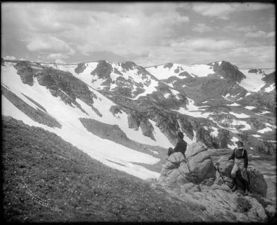
Beginning along the Continental Divide-- the ridge separating North America between the Atlantic and Pacific drainages-- the headwaters of the Boulder Creek Watershed range from James Peak in the southwestern part of the basin to Niwot Ridge and Navajo Peak to the north. Passes across the divide include Rogers Pass, Rollins Pass (also known as Corona Pass where narrow gauge trains once crossed the divide) and Arapaho Pass. Images include three large panoramas taken by Ed Tangen in 1921.
| Image/Location | Date | Photographer | Source/Copyright |
| James Peak | between 1900-20 | Harry H. Lake | DPL Western History |
| Corona Pass Snowshed (Summer) | 1910 | Unknown | DPL Western History |
| Corona Pass Snowshed (Winter) | 1910 | Unknown | DPL Western History |
| Clouds Near Fourth of July | 1935 | Donald Campbell Kemp | DPL Western History |
| Arapahoe Peaks | Unknown | Ed Tangen | Library of Congress |
| Arapahoe Peak & Glacier | 1921 | Ed Tangen | Library of Congress |
| Arapahoe Glacier & Lake | 1921 | Ed Tangen | Library of Congress |
| Timberline | 1935 | Donald Campbell Kemp | DPL Western History |
| Silver Lake | 1935 | Donald Campbell Kemp | DPL Western History |
| Glacier Lake | 1909 | Louis Charles McClure | DPL Western History |
| Glacier Lake | 1898 | Louis Charles McClure | DPL Western History |