Weighing
Factors and Q Values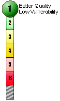
Why
isn't pH as important as DO...and how come Fecal Coliform is the
most important?
When
an index is put together, not all variables are equal. (See How
was the NSF index developed?) Who determines what indicator
is more important than another? Water quality experts....and naturally
experts will disagree based on their own understanding and research.
Experts with a background in aquatic habitat will likely have different
priorities than those focused on human health concerns. Thus, coming
up with one water quality index that everyone will be happy with
is virtually impossible.
The
EPA's Index of Watershed Indicators has attempted to bring in other
unscientific factors, such as "Meeting All Designated Use,"
(see sidebar) which is heavily weighted in the Index and is based
on local and in some cases biased attitudes of how a particular
waterway should be used. This approach can still provide a valuable
insight into a particular watershed's overall health, but its scientific
validity is compromised in the process.
The National Sanitation Foundation's Water Quality Index that BASIN
is making use of was created in 1970 and has been controversial
since it was first used. Numerous other WQI have been developed,
but we have used the NSF WQI as a way of beginning the ongoing dialogue
needed for our community to better understand the complex issues
of our local water quality. The NSF's experts determined that Fecal
Coliform was the most important factor in the index and should be
weighted most heavily, and that DO is more important than pH.
The
NSF system has also been criticized because several of the Q value
curves top out in the high 80s or low 90s, which thereby allows
for a maximum top score of about 97. Thus an A only covers a range
of 7 points while B and C each cover 20 points each, and a D 25
points.
|
EPA'S
Index of Watershed Indicators
How are indicators values and the overall
index calculated?
For each condition indicator, values were selected which, in EPA's
professional judgement, represent an appropriate basis to describe
the aquatic resources within the watershed as having good quality,
fewer problems or more problems. Similarly, for each vulnerability
indicator, the Agency selected values that we believe are appropriate
to differentiate "lower" from "higher" vulnerability. For most
indicators we established a minimum number of observations necessary
to assign a "score." In aggregating the 15 Indicators into the
overall Index, Indicator #1, Assessed Rivers Meeting All Designated
Use, is weighted more heavily than other Indicators because it
is a comprehensive assessment and EPA believes considerable weight
should be given to the State/Tribal 305(b)
assessment process. All other indicators are weighted equally.
Where there is insufficient data for a particular indicator we
will display that on the map and present it in the Profile. At
least 10 of the 15 data layers must be present to calculate the
overall index for any given watershed. If Indicator #1 is not
available, the values of the other indicators of condition are
multiplied by three to derive an Index score.
|
